

Visibility analysis evaluates what areas are visible from specific locations using digital terrain and surface models. This method is commonly applied in landscape assessment, visual impact studies and infrastructure planning to understand how proposed developments may be seen from surrounding areas. In addition to standard GIS viewshed tools, we apply enhanced visibility modelling approaches that incorporate refined terrain processing and analytical workflows to produce more reliable and realistic visibility outcomes. The resulting viewshed maps provide clear spatial insights that support visual impact assessment and project design decisions.
Spatial suitability modelling applies multi-criteria decision analysis (MCDA) to identify areas that best meet a defined set of spatial conditions. By integrating environmental, physical and planning datasets within a GIS framework, we evaluate spatial relationships and produce suitability maps that highlight areas with higher or lower potential for specific uses. This approach is widely used in site selection, environmental planning, habitat suitability studies and infrastructure corridor planning.
In addition to specialised modelling approaches such as visibility analysis and spatial suitability modelling, we provide a range of other GIS-based analytical methods to support spatial investigation and data interpretation. These include terrain and surface analysis, hydrological analysis, spatial statistics, interpolation and network analysis. These methods provide additional analytical perspectives that support spatial interpretation and informed decision-making across a variety of project contexts.
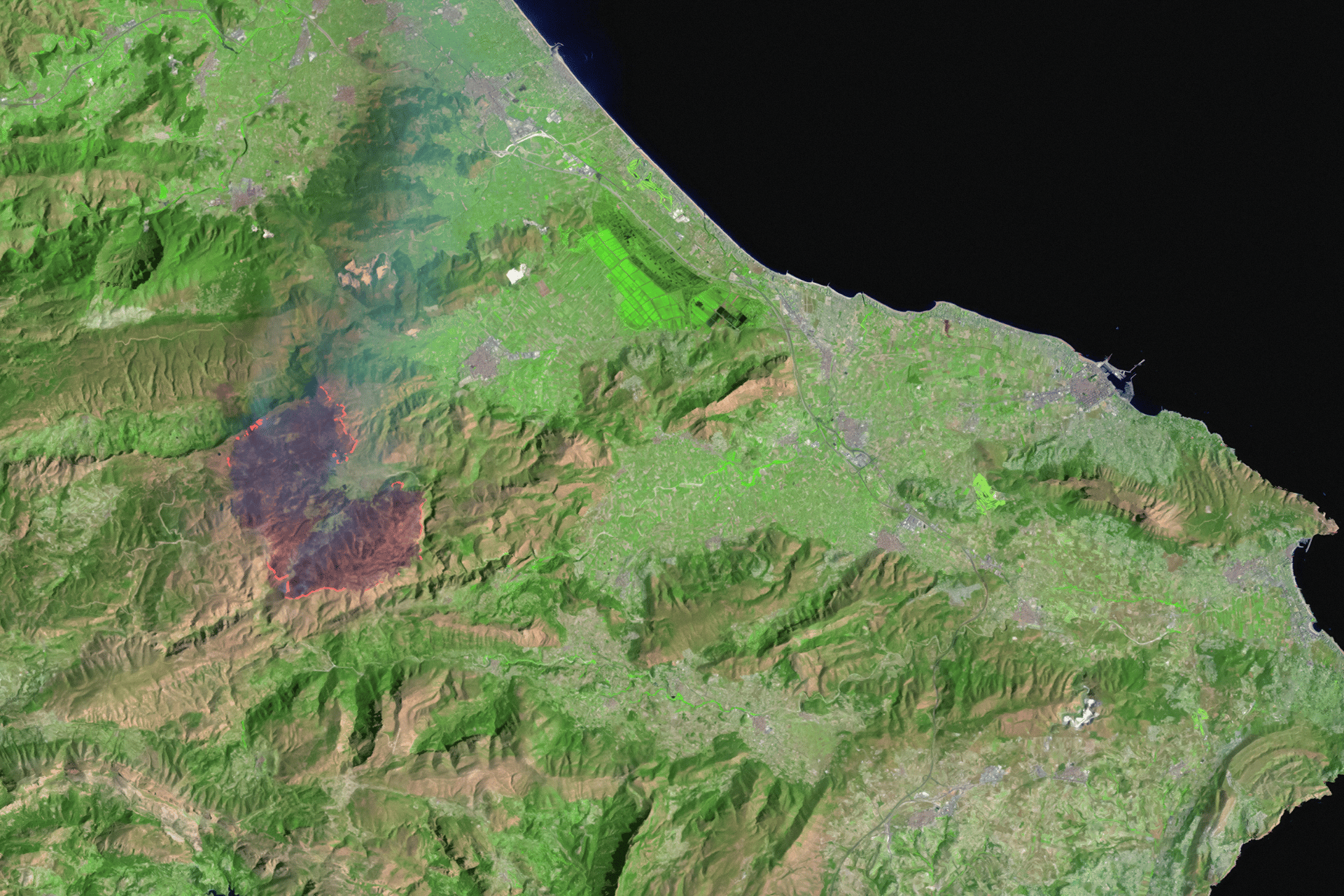
Remote sensing analysis uses satellite and aerial imagery to extract spatial information that may not be easily captured through conventional datasets. By applying techniques such as supervised classification, object-based image analysis (GEOBIA) and spectral index analysis, we identify land cover patterns, vegetation characteristics and environmental features from multi-spectral imagery. These analyses support environmental assessment, land cover mapping and spatial monitoring by transforming imagery data into structured spatial information that can be integrated within GIS workflows.
We provide professional GIS mapping and spatial analysis services to support environmental assessments, planning processes, and data-driven decision-making. Our work transforms complex spatial data into clear visual outputs and analytical insights that help clients understand constraints, evaluate opportunities, and communicate results effectively.

Effective spatial analysis and mapping depend on well-structured and reliable data. We provide spatial data management services that help organisations organise, maintain and improve the quality of their spatial and non-spatial datasets.

By combining field data collection with structured workflows and GIS integration, we help ensure that spatial data captured on site can be efficiently processed, analysed and incorporated into project datasets.
Whether you’re a farmer, distributor, or partner, we’re here to support your goals with sustainable solutions and global expertise.
.svg)